Septuagenarian Surprise

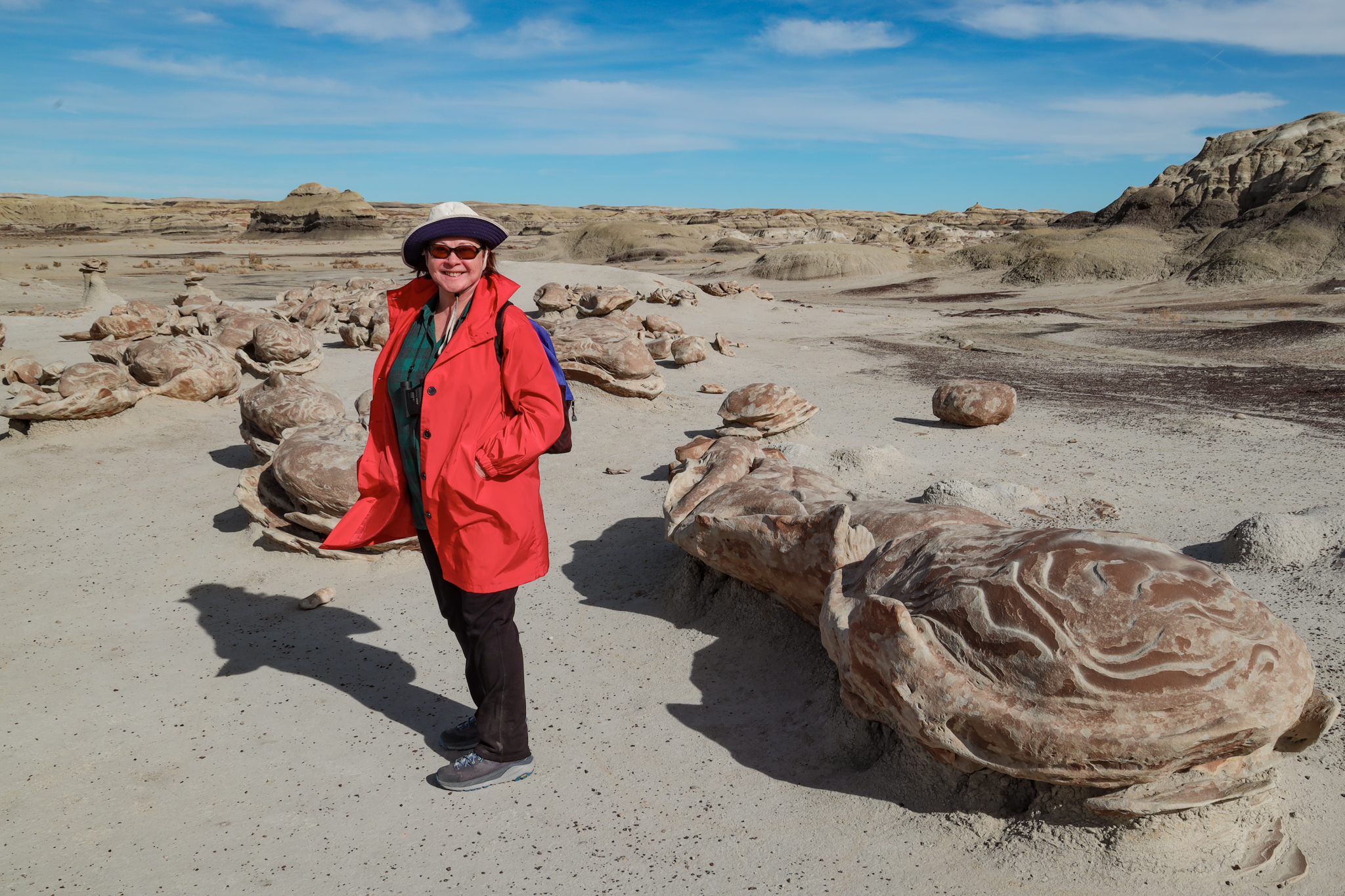
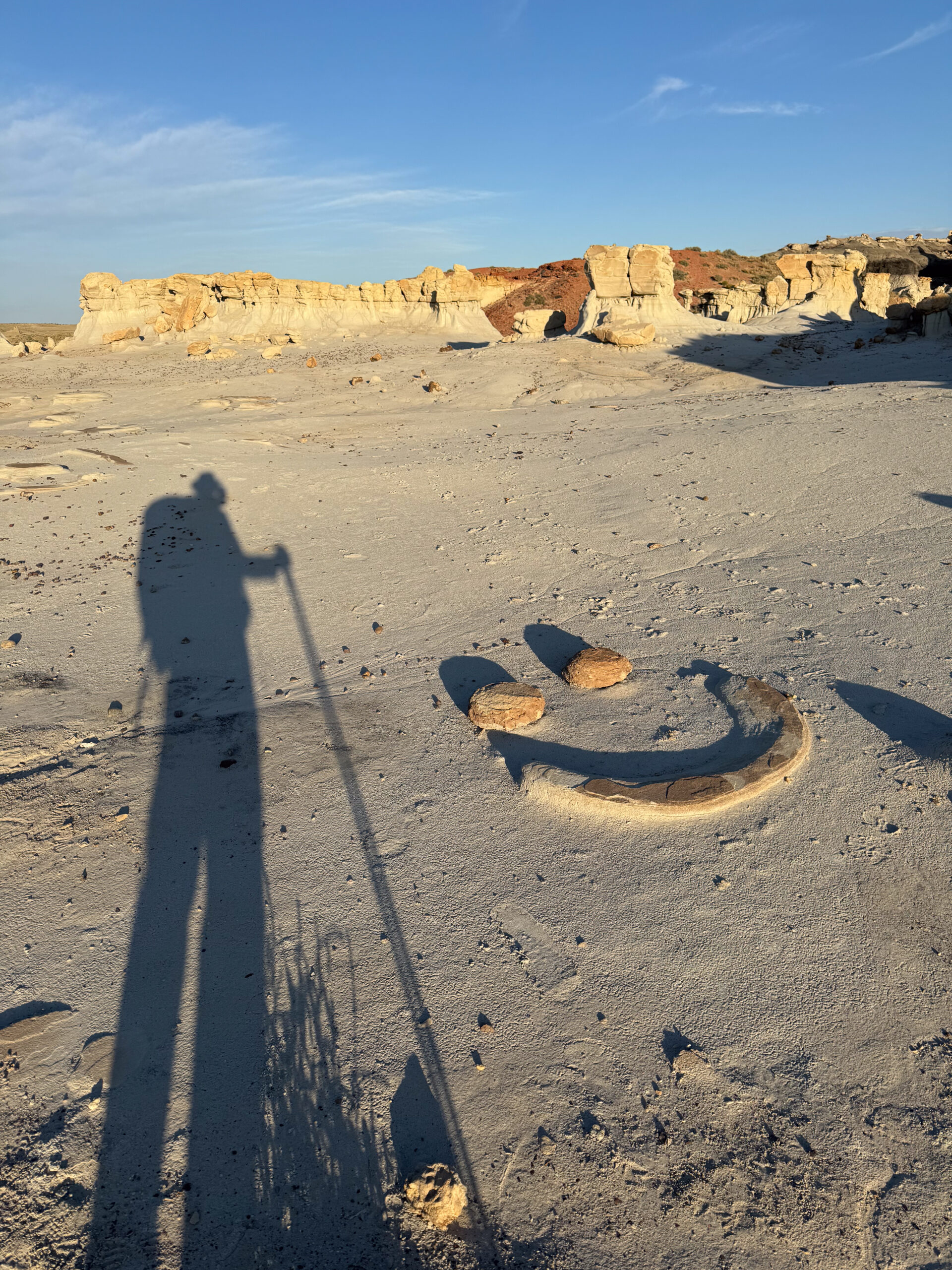
Hiking through the desert in the morning after an overnight photo session.

“Can I still do it?” and “Will I still enjoy it?”

I find myself asking these two questions about various activities I undertake.  Now maybe you are thinking I am making oblique references to sex, but so far, that hasn’t been in the category of activities I am questioning. 

I noticed that, after turning 70, my superpowers appeared to be diminishing.  This was a surprise to me because so far, at every decade mark, I had felt little difference from the previous one.  There were a few things I suppose– certainly my appearance has changed as I have grayed, but for the most part, my capabilities have held.  

Until now.  I am starting to notice that my flexibility is less; I am stiff in the morning; my strength and stamina are diminished.  Something has happened to the sinew and grit that powered my younger self.  The analogy I entertain is:  “the rubber bands are drying out”.  

My limitations became apparent in a recent outing to take pictures of the night sky, an activity I have enjoyed for decades.  One of my life highlights was recording pictures of the night sky on Racetrack Playa in Death Valley a few years ago.  Currently, it is a similar trip with a hike to a collection of geologic features in the badlands of New Mexico.  I treated it like many others I had undertaken, but this time, things felt different.

During my “Nightscape Odyssey” in 2001, I would survey a candidate night sky site during the day, making notes of how to get there, what compositions were promising, and generally getting familiar with the area.  I would then return to the site later, as twilight approached, or sometimes even in the dark, and set up my telescopes and cameras.  It made for a long day, and a long night, and I was usually exhausted the next morning.  Nevertheless, after a morning nap, I would start the process all over again for the next night’s session.

This time, I was prematurely worn down after the initial reconnaissance and had to postpone the nighttime excursion until the next day.  I didn’t expect that.  Maybe it was the heat, or maybe it was the elevation, but those were factors before, and back then I still had the energy to carry on.

The lure of an image in your mind’s eye is a strong motivation, and I was very excited to see if I could capture the Milky Way behind the Alien Throne, my target for this outing.  I described the overall experience previously, but I will now describe some of my other reactions as I undertook it.

I mentioned that my backpack was heavier than I expected.  Yes, it had an excess of camera gear, but that was the payload.  The rest was support: water, snacks, and protection against the desert night.  The total came close to forty pounds, a typical number for a much longer trip.  It was well within the range of packs I had carried before, and tonight I only had to go 1-1/2 miles over relatively flat terrain.  I put it on, cinched the hip belt, and felt the familiar shift of my center of gravity as I took the first steps down the trail.  It felt good to be doing this again.

As I continued, I noticed that I could feel the load in my legs.  This was not a daypack.  I could also sense some strain on my knees.  This reminded me of an incident that happened a previous time I had carried this pack.

It was fifteen years ago.  I had been on a weeklong backpacking trip, and on the last day, while climbing a ridge along the Lake Superior Hiking Trail, I experienced a sudden collapse of my right knee.  It was truly a surprise; I fell to the ground.  It wasn’t painful, my leg was just uselessly limp.  My hiking buddies helped me back to my feet, but I couldn’t sustain the weight of the pack and collapsed again. Fortunately, it was only a short distance to our destination, and by distributing most of my load to the others, we were able to get there.

But here I was, hiking solo in a wilderness area as night approached.  If the same thing happened, what would I do?  I was a mile from my car, but to get there, I would have to abandon my load:  $5000 of camera gear.  Well, I guess I should factor that into my choice to embark on these excursions!

I carried on.  And I carried the hiking poles that Poldi had lent me.  I had always considered them a nuisance, getting in the way of my path and interfering with handling a camera, but I was now starting to appreciate them.  They bore my weight and guided my traverse across the ruts and ridges in this rugged landscape.  What was once an annoyance has now become a dependence.

I made it to the Valley of Dreams, following the route I had traveled the previous day, but the Alien Throne was another half mile through uncharted ridges and eroded gullies.  I could see the destination on my GPS, but the terrain was not adequately shown.  I found myself blocked by box canyons and cliffs.  My strength was waning, the sun was setting, and I wondered how many more of these obstacles I could clamber over.  If I became stuck, I would just make the best of things, taking pictures of whatever features were around me, even if they weren’t my prime target.  It could still be a wonderful evening.

I was getting close, but a sudden drop-off was in the way.  It was too high to scramble down, especially bearing my pack.  So I removed the pack, lowered it over the edge, and then eased myself over and dropped down onto it.  This was the last obstacle.  I rounded the corner and found the Alien Throne!  But it was not lost on me that this was an obstacle that in earlier days would not have presented a challenge.  Further, had I not had a semi-graceful landing on my pack, what injuries would I have sustained?
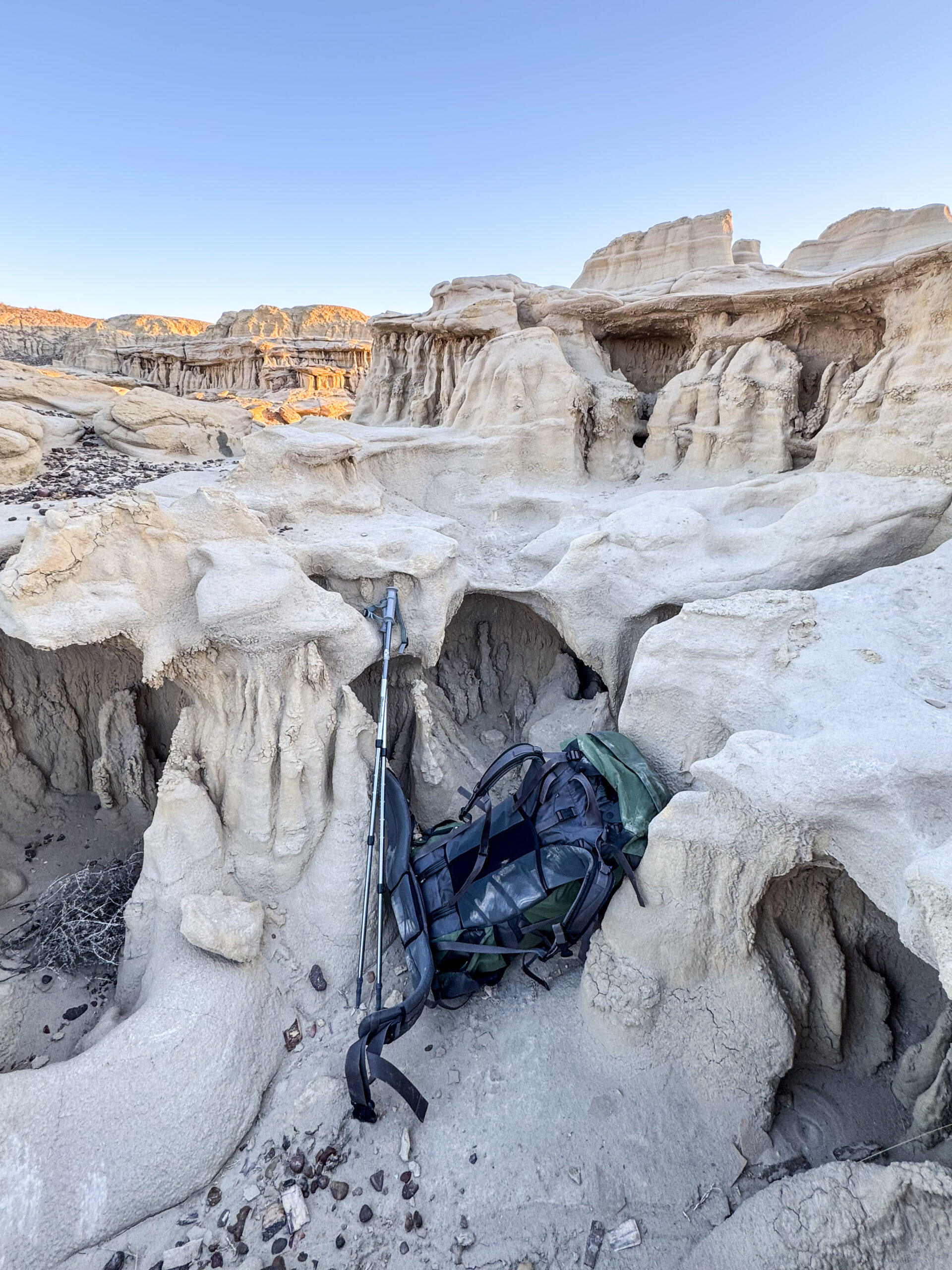
It was a small barrier, but I was stranded on the shelf 5-feet above the valley floor I needed to get to.  I dropped the pack and eased myself over the edge onto it.

I filed those thoughts away as I looked over the theater containing the Alien Throne.  I needed some time to recover my breath after the stress and strain of navigating these eroded features, but I was aware that the light was rapidly changing.  I needed to get my cameras set up.

This is a very pleasurable part of the adventure.  I am finally at the site and can look for the compositions I have imagined.  It is a mix of guidance and guesswork.  I have some tools to help with orientation and timing, but it really takes placing an eye to the eyepiece to see how the landscape fits the sky.  There are technical issues to resolve as well: exposure times, lens apertures, focus, and shutter intervals.  These keep me narrowly focused on my goals and shut out any other concerns (I’m oblivious of the need to worry about scorpions).

But as I placed each camera and tripod in its place, I could not help but notice each difficult position, and each awkward angle I had to assume in doing so.  Yes, the terrain is uneven, and the viewpoint requires the right height and angle, whatever it needs to be for the composition, but I don’t remember it being such a physical strain to achieve it.  

Kneeling is a particular motion, required for just about any adjustment.  I find that it is hard to get back up.  And when I drop something, it becomes a major project to recover it.  The aches and pains of drying rubber bands were making themselves known in this otherwise pleasurable setting.

But when the cameras are each in place and running, I heave a sigh and settle in for a night of watching the heavens flow across the sky.  It will be an hour or more before the cameras need attention.  This is another pleasant part of the nightscape adventure.  I record the photographic details of my experiments in a notebook and contemplate what the outcomes might be, and what subsequent exposure tests I should undertake.  When I am with Poldi, we find spiritual and intimate activities to fill the time under the stars, but on this night I am alone, at least for a while.  Soon after my cameras were set up, another night sky photographer arrives.  We share our stories while the stars move above us.

We eventually retreat to our refuge against the cold desert night.  I am in a sleeping bag tucked into a recess in the rocks.  I relax here, watching the sky above and listening.  There is a cricket chirping.  I am astounded at how loud it is, and then I remember, I now have “bionic ears,” recently acquired hearing aids, another indicator of crossing the seven-decade threshold.  They have been tuned to amplify the high frequencies that I was previously missing.  This helps me to understand the speech of women and children, but it really helps me to notice the frequency of cricket chirps, which are slowing as the temperature drops.  The chirps keep me awake.

But eventually they stop, or maybe I drift off.  When my alarm goes off for the next exposure event, I climb out of the sleeping bag and stumble toward the camera that needs attention.  The moon has set, and it is now purely starlight that guides me.  Plus my flashlight, because starlight is just not enough, at least on this uneven terrain.  As I navigate over the rocks toward the camera, I recognize the precariousness of my path.  At home, at night, in the dark, I must sometimes navigate to the bathroom.  It is much easier with a nightlight– so we have installed them.  Here, in the certified dark sky wilderness of New Mexico, I am on my own.  I am aware and notice the uncertainty of my steps on the sandstone terrain.  Loose gravel and vegetation contribute to the hazard.  Once again, I recognized that if I fell and was injured on one of these camera servicing missions, I would no longer be enjoying the night.

But the cameras, with their new exposure settings and refreshed batteries, continue their nighttime schedule.  I return to my nook to marvel at the Milky Way, now high in the sky.  The cricket reminded me that I have bionic ears, but the sky reminds me that I also have enhanced eyesight.  

The miracles of modern optics can correct for obscure vision conditions, including astigmatism and other aberrations.  I put on my progressive prescription glasses so that I could appreciate the full glory of the night sky, beyond my now compromised seventy-year-old built-in lenses.  It was a bust.  For whatever reason, my glasses made the view worse, not better.  I will be investigating this failure, but in the meantime, I enjoyed the night sky without optical assistance.

The pleasures of the night continued; the cameras were serviced despite the risks, and eventually the sky began to lighten.  Dawn was approaching.  

The exposure schedule ended as the sun rose, and I gathered my equipment, preparing for the hike back. The night before, I had reached my destination just before my strength ran out.  Now, after a night to recover, I expected an easy hike.  I knew the way.  And it started that way, but soon became hard.

It was not a difficult trail, mostly level.  And the sun was still low, the temperature moderate.  The path was easy, but on encountering the slight banks in and out of a dry creek wash, I was annoyed that I could not just scramble them; I had to take carefully placed steps.

Only a mile and a half back to my car.  Yet, I found my feet becoming “heavy”, without the lift to rise ever slightly for the next step.  And they were sloppily planted in that next step.  It was the closest thing to a stagger, and I realized it.

So I paused for a rest, dropping my pack for a while.  Sitting on a rock and taking some water, one of my hiking poles fell to the ground.  I cursed.  Now I would have to bend over to get it.  When did just stooping down become such a pain?  I have never enjoyed getting under the desk to plug in computer or power cables, but just bending over to pick up something I dropped?  That’s new.

Reaching the point of involuntarily dragging my feet was a new experience, a physical regime I was unfamiliar with.  It made me appreciate the limits that people sometimes overcome, not just for recreation, but for survival.

And it added to my list of items to balance against the pleasures of my remote outings.  I really enjoyed the hours in the desert monitoring cameras and watching the galaxy cross the sky.  But I have become aware of the risks I am taking on, some of which seem to have increased over my years.

I was halfway back.  I was aware of the remaining distance, which was more than the physical distance.  It included the depletion of my energy reserves.  I may have been staggering, but I was not to the point of stopping.  I hoisted the pack and continued back to the car.

I can now declare that “I can still do it”, and I will also declare that “I still enjoy it”, but I must temper this last statement by acknowledging that the enjoyment is diminished by the increased risks I take on.

Life is filled with tradeoffs.

It may seem that I am complaining about getting old, and I guess I am, but I am also thrilled that I am still around to do so.
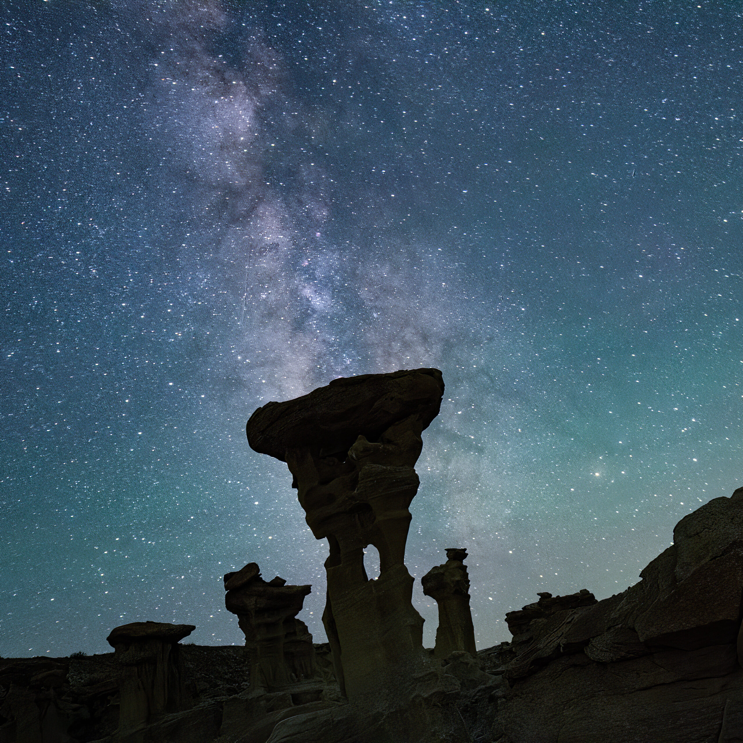
My motivation, an image in my mind’s eye becomes real (click for full resolution).

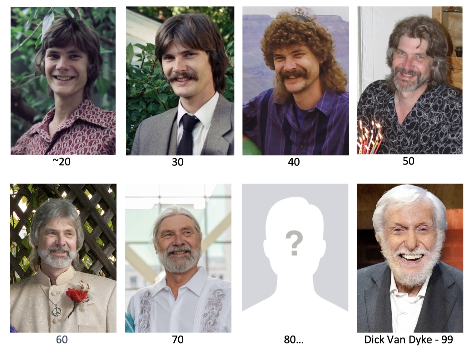
If I look back a little, I might be able to extrapolate how this next decade will go.  So far so good.  I hope I can be as spry as Dick Van Dyke when I get there!

Valley of Dreams, Part 1: Finding It

The American Southwest is an amazing, mysterious, and visually stunning place. I’ve had a fascination with it my whole life, and make excursions whenever an opportunity arises.  A few years ago, Poldi and I discovered an area in New Mexico with remarkable geologic features:  badlands, hoodoos, and petrified wood!  It was the Bisti Wilderness Area, held apart from private and reservation land by the Bureau of Land Management for the benefit of the public.  It is only very lightly “managed” by the BLM.  There are no visitor centers, no picnic areas or campgrounds, and no trails.  There is a small parking area at the end of a difficult dirt road, marked by a signpost and featuring an outhouse.  

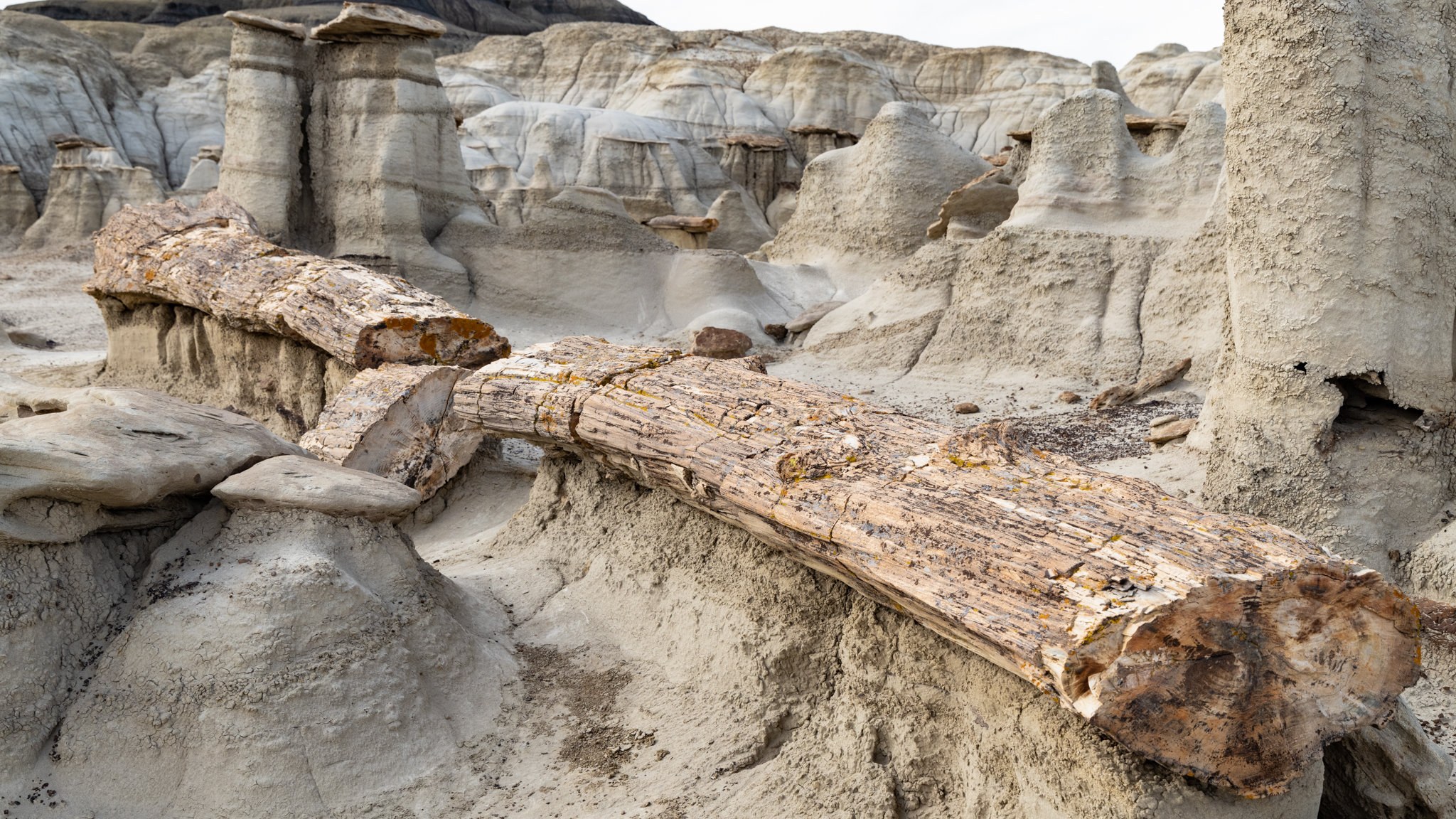
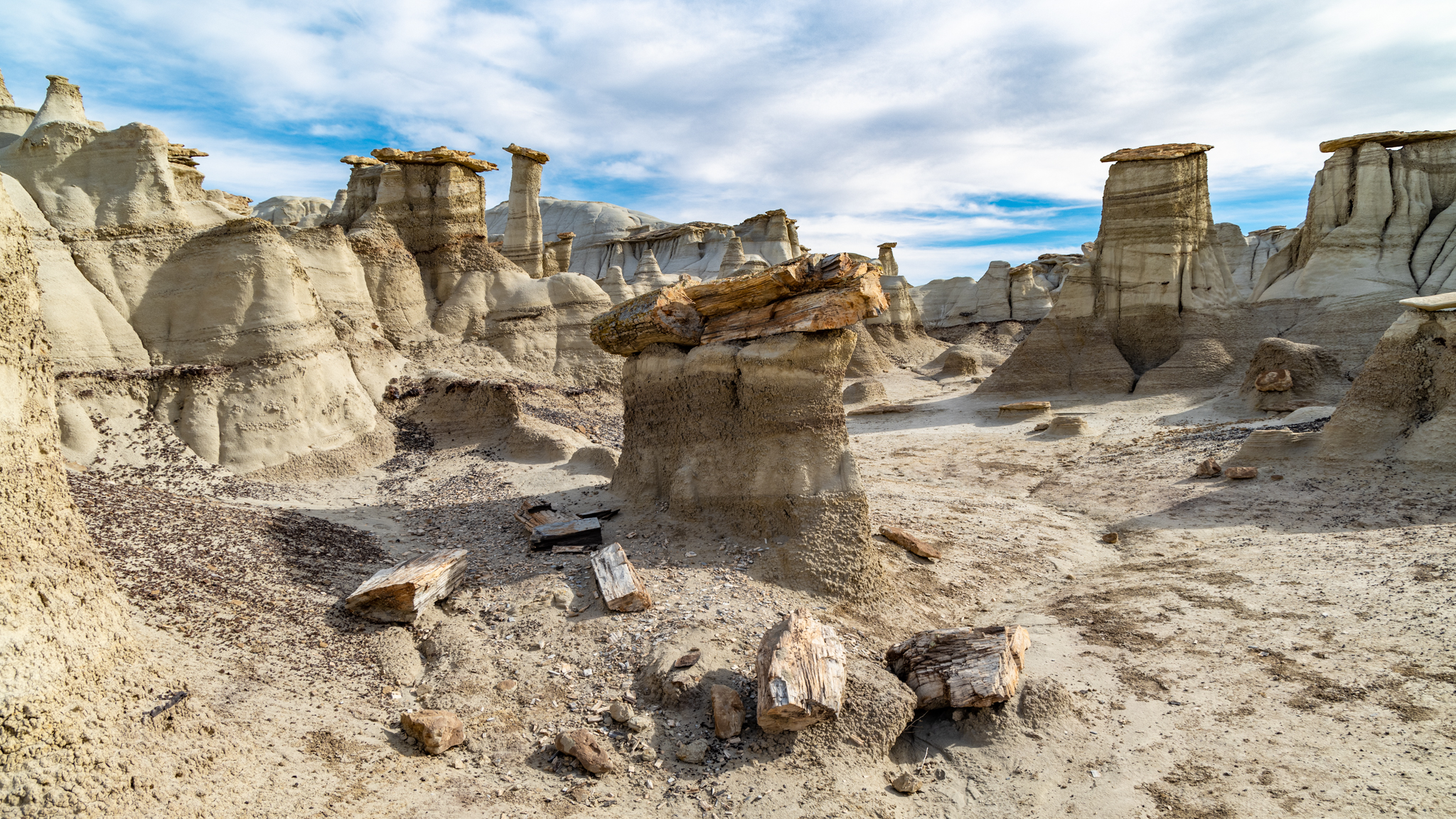
Despite the lack of trails, we were able to follow the breadcrumb descriptions posted online by a photographer who explores Bisti for its photogenic subjects.  We located and visited the Alien Egg hatchery, a 30-foot-long petrified log, and a hoodoo village.  In the years since, we have wanted to return and explore more of this fascinating area.

We were able to do so this year.  The timing was right—late Spring, before the desert becomes intolerably hot.  We both researched and found several more sites with novel features bearing names like “King of Wings”, “Chocolate Penguin King”, and “Alien Throne”.  These are not roadside points of interest with explanatory markers; they are deep in wilderness area, accessible to intrepid hikers willing to explore the desert and locate them.  Those that are successful bring back stunning photographs.

Those photographs inspired us to consider visiting them.  A particularly novel feature, “The Alien Throne”, made me wonder if I could get a picture of it with a night sky backdrop.  I read the accounts of others who had made the trip.  Maybe it was possible!

After deciding on this photographic target, I needed to find it!  There are several levels involved in “finding it”.  Navigational dead reckoning by hiking the desert is one level.  Based on GPS coordinates, it could be located on a map, but how to even get close?  Ideally, you’d drive to the nearest point on the nearest road and hike from there.  That seems easy enough if the roads were like the ones you find on state highway maps, identified by number and by road type.

But the roads throughout this area of New Mexico are not like those roads.  They range from a regular width of gravel, to narrower washboarded and eroded dirt roads, to pairs of ruts, to a single path indicated only by a slight contrast in vegetation.   In fact, they are sometimes not even visible on the satellite views presented on Google Maps.  Were it not for the Google label overlay, some of the roads would not be identifiable.

The roads do have numbers, often multiple numbers: state, county, and reservation, each with a distinct designation.  Not that it matters.  When on one of these back roads, there are few identifying signs showing any number at all.

We had no fewer than four navigational tools to help us.  My trusty old standard is a state road atlas, printed as 90 pages of large 11×17 B-size paper sheets bound into a book.  This revealed land ownership status and showed details, including unpaved roads, but only down to the officially maintained gravel roads.  The lesser roads were not shown at all, yet we needed them to reach our desired access points. 

In addition to the paper atlas, we had electronic tools:  the mapping applications on our phones, a route display in our car (Volvo calls it “Sensus Navigation”), and a handheld Garmin GPS receiver marketed for outdoor enthusiasts.  Having been raised on paper maps and magnetic compasses, I have mixed attitudes towards the electronic tools.  I have owned GPS receivers since 2000, starting with a gift from my mother-in-law, who thought it was the height of silly electronic gadgets (but she knew I would love it).

And they are indeed amazing gadgets for locating one’s position on the planet, but less amazing in identifying orientation, and a bit scary in terms of being dependent on batteries and infrastructure (cell phone and satellite signals).  

The phone is our main navigational tool on the road because its display and user interface is the most supportive.  But it is highly dependent on being in cell phone range.  Outside it, one will see a blue dot representing our current location, but in an ocean of gray—the maps that provide context are loaded on an as-needed basis from the cell phone network.  No cell tower nearby, no map.

I am also skeptical about its GPS capabilities.  My phone does not have the characteristic stubby antenna for GPS wavelengths; how does it see enough sky to get the triangulation data from the satellites?

The car’s Sensus map worked well, but was harder to operate, and suffered some of the same limitations—the map data did not always show.  It was better than the phone; I think it has better local storage of map data, but as with all electronic mapping, there is a “level of detail (LOD)” display control that depends on how far you are zoomed in.  If it appears that your blue dot is lost in space, not on any route, zoom in some more, and the lesser roads will show up.  I often wish I could override the automatic LOD to show more or less of the map detail around me.  But even fully zoomed in, we noticed that some of the backroads were invisible—an apparent gap in the map data.

The Garmin receiver (Montana 610t) was the most reliable in getting a signal—it embeds the stubby antenna and it carries all of its mapping data internally, so our location was always displayed and the map seemed to have ALL of the near-invisible back roads.  The Garmin, however, suffers from a klunky user interface.  I might call it user-hostile, but instead will generously label it as “industrial”.  It uses a touch screen that requires a heavy hand, an awkward data entry screen, and the functions are just not intuitive (to me).  As a result, even after five years, I barely know how to operate it.  

Its greatest weakness, however, is the power supply.  GPS receivers don’t need power to transmit, but they must detect very weak signals from satellites hundreds of miles away and make complex calculations on them.  The built-in rechargeable battery might last a day or so, but on this trip, it failed to recharge.  It could be replaced by lithium AAs, so I now carry spares.   Despite this shortcoming, the Garmin was definitely the unit to bring on our excursions into the desert.

The Garmin was superior in its location display, but it was an app on the iPhone that helped us locate the route to the Alien Throne.  Apple Maps and Google Maps are wonderful applications that have changed how we get from place to place.  But they are designed for driving, public transport, bicycling, and walking urban streetscapes.  There is another application focused on hiking in backcountry settings:   AllTrails (alltrails.com), from a company that caters to those of us who enjoy exploring the many hiking trails out there in the world.

They collect and publish maps for these trails, and they support a community of hikers who report back on their experiences and offer advice and photos.  The maps can be downloaded to your phone (while connected), and then are available to show your position while on the trail, regardless of cell phone coverage.  It turns out your phone is still in contact with the GPS signals (even in airplane mode—recommended to conserve battery life).

There was a trail in the AllTrails library for the Valley of Dreams.  This was the navigational help we needed, not only to find our way through the unmarked desert, but also to find the access point!  Although we were not at the trailhead yet, the AllTrails map showed us where we were with respect to it, and the roads (numbered or not) that could take us there!

This is how we located the trail to the Alien Throne.  The AllTrails application guided us to an informal parking area.  There was a clear trail that started here, but then dissipated onto the sandy washes and scrubland of the desert in front of us.

We had located the trailhead, a wide spot to the side of one of the “pair of ruts” roads in the New Mexico badlands.  We marked the location on the Garmin GPS, and returned to Farmington to prepare for a hike the next morning.

The weather was clear the next day, and we were excited about hiking to the Valley of Dreams, but it took 1-1/2 hours to return to the trailhead.  The day was heating up as we embarked.  We had come for the unusual and novel beauty of the desert and this trail really embodied it.  It was a little over a mile to reach the area of wind and water-eroded shapes contained in the Valley of Dreams.  On the way we encountered other badland features, previews of hoodoos, dry creekbed washes that hosted flash drainage during rain, and the hardy patches of vegetation: cacti and tumbleweed, that somehow make a life here.

Normally, I estimate a two-mile-per-hour rate while hiking over flat terrain, but for whatever reason (trail conditions? distractions? age?), we took twice as long.  There really isn’t a trail here.  It is a broad, flat area of desert scrub punctuated by interesting geologic features.  Distracted by them, we strayed from the AllTrails route, which, because there is no trail; is just a recording of some person’s path.  The application would alert us that we had gone off the trail (“Did you take a wrong turn?”).  This was both annoying and reassuring.

We reached the Valley of Dreams around noon and entered a region of highly eroded features, areas separated by chasms and gulleys, clearly carved by water, but completely dry today and most days.  We found ourselves off the prescribed route and trying to figure out how to not get trapped in some box canyon.  We climbed out of one and into another, but eventually found (or think we found) a feature we had read about:  the giant mushroom.  

And then finally, the Alien Throne!  It evoked a sense of both awe and less.  As large as it was, sitting amongst its peers in this setting of similar thrones, it did not match the scale that we had cultivated in our minds’ eye from the photos we had seen.  Yet it was unique, so eroded by the elements that its supporting column had been eaten through, and the penetrating holes provided viewports to the vista behind.  We marveled at it, took photos from all angles, some selfies, and then had lunch under it!

The heat had suppressed our hunger, but our thirst was unquenchable.  Electrolytes had fueled our passage to this point, and now apples and grapefruit were the preferred lunch nutrition.  We slowed down, caught our breath at this elevation (7000 ft), and enjoyed a moment in the sparse shade of this alien monument.

I was scouting for potential nighttime compositions when I noticed that I could no longer read my position on the AllTrails map on my phone. It had gone dark.  Yes, it was high noon in broad daylight in the desert, so I expected the display might be hard to see, but this was significantly dimmer than I had experienced during the hike to this point.  The brightness setting was maxed out, but only a faint image, too dim to read, showed itself.  The AllTrails app, which up to now had surpassed my expectations, had suddenly failed.  I tried various help-line-advice type tricks, like stopping and restarting the application.  I shut down every other application that might be running in the background, but the problem persisted.  Finally, I shut down the entire phone and restarted it.

A few minutes later, the phone came back to life, the display once again readable.  I was relieved.  We were never in any danger; it was just a reminder of being out on a technology limb.  And in fact, a few minutes later, the display dimmed again, rendering the AllTrails guidance once again useless.

Later, I would learn that this was not an AllTrails problem, but rather a “feature” of the iPhone platform it lived on.  When the operating temperature exceeds a certain threshold, the phone cuts back on its power, the display being a big part of it.  Even though my body temperature is regulated, and the phone is not even trying to transmit while in airplane mode, evidently sitting in my pocket, or in my hand during a hike at noon in the New Mexico sun was too much for it, and it went into a lockdown safe-mode.

Fortunately, we had our printed maps.  They didn’t need batteries, and we could read them even in bright daylight.  Although we were never in danger of becoming lost or unable to return to our car, we really wanted to find the remaining cool features in the Valley of Dreams, so we set out from the Alien Throne to find items with names like The Turtle, Petrified Log, and the Chocolate Penguin King.  We somehow managed to locate them using our stone-age technology.

We eventually found ourselves back at the entry point to the Valley of Dreams and headed back to the trailhead.  Poldi, making the calculation that a straight line was the shortest, led us across the desert in a beeline, never mind the snakes and cactus.  She knew that there was a beer packed in an ice chest waiting for us in the car.

It was an exhilarating day, one that we will be adding to our life highlight list.


Science or Sentiment

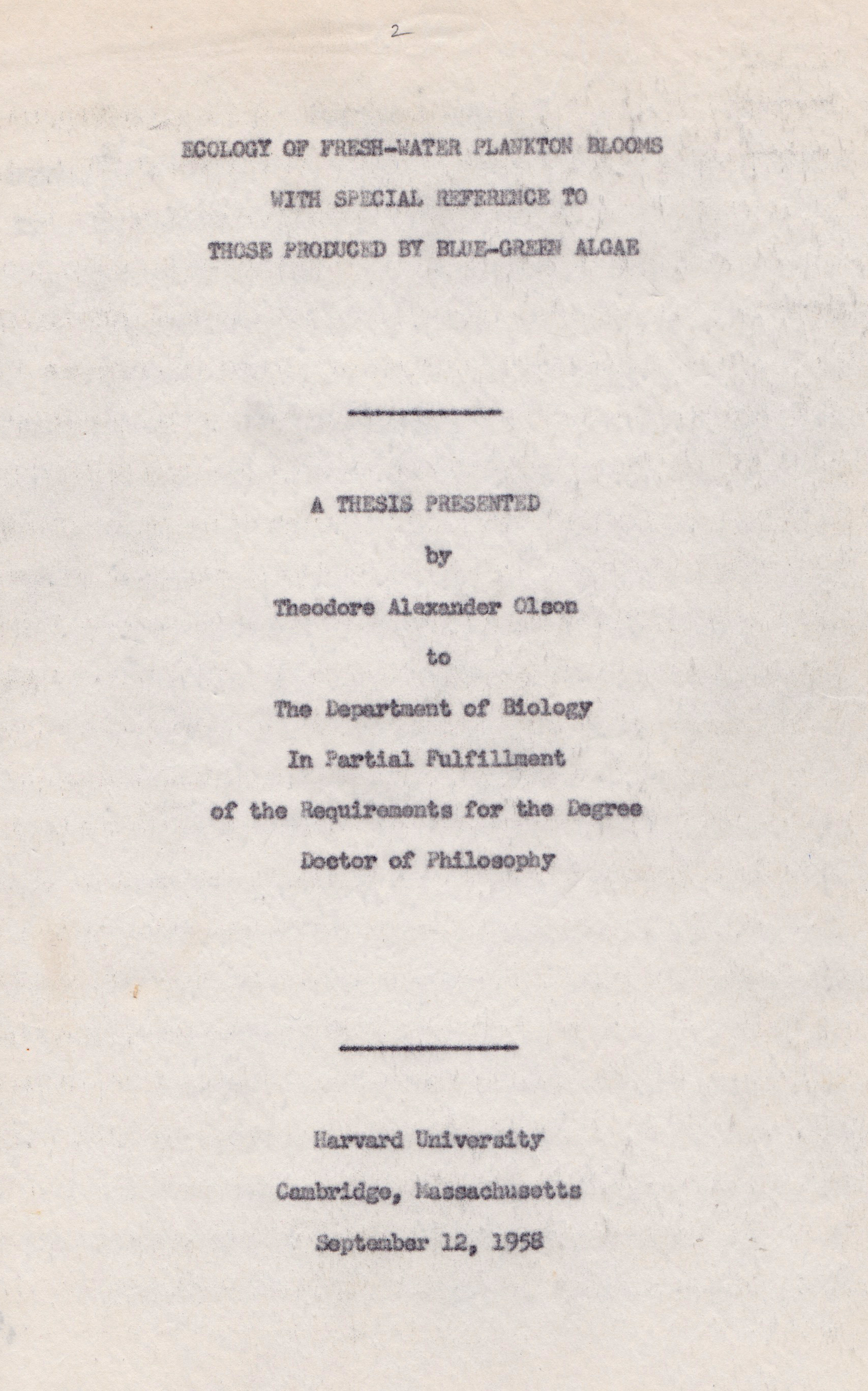
The title page of my grandfather’s PhD thesis, a thick volume of scientific discovery, each page typewritten in carbon-paper triplicate by my grandmother during their time at Harvard. Interestingly, it was submitted on his (54th) birthday.

“Long before the term ecology became a part of the vocabulary of the scientist, primitive man, looking out over the expanse of blue-green water which characterized his favorite fishing haunt, was probably aware of the fact that notable alterations in the color and clarity of this body of water would occur as the seasons changed.”

The introductory sentence of Theodore Olson’s PhD thesis on algae blooms.

I was witness to my grandparents’ transition to an assisted living apartment from the home they had kept for more than half a century.  Though modest, it was the center of a busy family’s activities, and had accumulated the corresponding mementos through the decades.  It had also collected the technical artifacts of my grandfather’s scientific career, specimens of insects and fish and algae from his ecological and entomologist specialties.  He kept copies of his and his peers’ published works, along with those of his doctoral students, who carried on these disciplines, with the scientific rigor and methods that he taught them over their years in his tutelage.

I was there on the day when he had to empty the ‘wall of books‘ in his home library, which included the dissertations of his students.  There was no space for everything at the new apartment.   A few important reference volumes could be retained, but the others?  What to do with them?  Here were the compiled and distilled understandings of pioneers in biology, acquired through years of painstaking research, building upon the pyramid of human knowledge.  These breakthroughs of their time have now been incorporated into our general understanding of modern biology. 

What should happen to the first-ever photomicrographs of blue-green algae blooming to produce cyanobacterial toxins?  What should become of the tabulated counts of seasonal species of mosquitos that were the vectors of mosquito-borne diseases?  What should be the fate of that first chart correlating taconite processing and asbestos-like fibers in Lake Superior?  All of these new discoveries had been first reported in his research and in the dissertations of his PhD students. 

Continue reading

Epilogue (from the future, 2020)

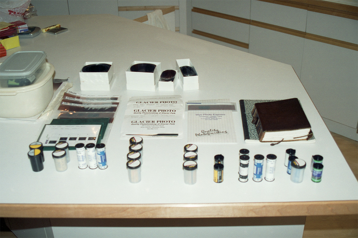
The kitchen table holding rolls of film of various types and sizes, some already developed and sleeved, others containing latent images awaiting their delivery to a film lab.  Also shown are my observing notebook and journal.

It has been a wonderful time-trip to go back and review my journal entries, voice memo transcriptions, collected travel brochures, and observing notebooks to recreate these stories.  Some of the material was outlined and posted on an early web site, but the impact of 9/11 a few weeks after my return from this trip, combined with the urgencies of daily life with my active family, derailed the project.  My notes and artifacts have been hibernating these years since in an ignominious cardboard box. 

The film that I brought home was processed by a professional photo lab and carefully organized into sleeves and folders and correlated with my observing notes.  The images that stood out became popular prints that I presented at art fairs and exhibits the following year.  The others kept silently in their folders in my file cabinet until I looked for supporting images for these stories.  I have enjoyed scanning them and discovering pictures that deserve more attention.

My notes from immediately after my return offer some advice.  Though today I do not recall it this way, my last night in the field with the windmill was recorded as a miserable experience, a disappointment of trying to reach a closure by recreating the first pictures from the outset of my trip.  Maybe seeing a successful film image a few days later, erased that negative emotion.  Today I enjoy reciting the story of being lost in the hayfield; at the time, it was just too frustrating.

In my notes I wrote that I took too much stuff and my plans were too ambitious.  Today, I’m not so sure.  My internalized boy scout motto, “be prepared”, provided the tools and materials when I ran into trouble in the wilderness– situations that could not be solved by a quick trip to the mall for repair items.  There were many times that I was glad to have the resources that I had brought.

As to the ambitious plans, they might have been a setup for disappointment, but I no longer see it that way.  I am appreciative for all of the experiences and opportunities that presented themselves.  Maybe this is just a way of life for me; there is far more to learn than I can possibly take in.  In the years since, I have learned to live with this limitation.

The road trip format– travelling every day– was not particularly good for deep sky work.  Because of the high overhead for setup and alignment and focus, it would have been better to stay in one location for several days.  I made the error that first-time travelers to Europe often make:  trying to fit everything into a whirlwind tour.

In the end, because I couldn’t do everything, I had to prioritize.  I favored shots that couldn’t be made from near home—so the startrails with unique foregrounds took priority and the deep sky shots that could, in principle, be made from anywhere on a clear night, were secondary.

Today, GPS is ubiquitous.  At the time, before cell phones, specialized receivers were required.  I had an early model, a gift from my mother-in-law who rolled her eyes about the whole concept but took pleasure in my delight at receiving it.  The GPS receivers were quite primitive by today’s standards of localized maps that show you the nearest coffee shops and the route to get to them; instead, they displayed your numerical latitude and longitude and could record markers (waypoints).  They could also show a trail of breadcrumbs of your recent route on a blank background.  If a major city was nearby, the display would show a mark and a label for it.  Still, as limited as it was at the time, GPS was a terrific aid to my efforts.

In the days before smart phones, there were “personal digital assistants”, PDAs, and I owned a Pilot, that hosted helper programs before they became known as “apps”.  One such program, Sol-2, told me the local sunset, twilight, moonrise, and moonset times based on my location, which I could enter by reading it from the GPS unit.  This was extremely beneficial for my nighttime photo planning.  Today of course, all of this is available from your pocket computer/smart phone.

I have often referred in these stories to the difficulty of getting enough sleep.  With the demands of cross country travelling, and nighttime photo shooting, sleep is postponed until it can’t.  I learned that an hour or two nap is extremely beneficial.  Even if not fully sleeping, the momentary metabolism slowdown of just resting seems to help. 

The solo time on the road was a contemplative opportunity.  My mind wandered over many topics as the miles rolled by.  Most of those idle thoughts went unrecorded, with no subsequent loss to society;  others I made notes of and have tried to convey in these essays. 

The opportunity to undertake projects like this do not occur often.  When they do, they are not always apparent.  I am indebted to my wife Vicki, who recognized the moment for what it was and encouraged me to embark on this adventure.  She saw that this was exactly the right thing for me; I encourage everyone to support the dreams of their partner.

And for those of you reluctant to embark on something that is outside of your usual style, I encourage you to push past the discomfort and seize the moment. 

Consider the lesson I learned from the visit with my old classmate (Tillamook Friends…).  That story was the result of wondering if I should take a tangent trip to Tillamook to meet him. The easier choice would have been to not go, to stay in my introvert’s comfort zone and get back to my solo photography.  But had I not taken that normally untaken option during that summer trip long ago, I would not have renewed a friendship that then lasted until he passed away last year, and I would now be regretting the missed opportunities to have shared in part of his fascinating life.  

It’s another reminder that life is short.  When risky or expensive or uncertain opportunities come up, take them.  Most people regret the trip not taken. 

And when you find yourself under a clear night sky, take a few moments to look up at the stars and contemplate our place in this corner of the universe.  We are blessed to be here, to have a life to fill with experiences and activities, and to share them with the people we love.

Thor Olson
October 2020

Nightscape Odyssey
previous | contents | next

12.3 Windmill Whiteout

Ah, South Dakota.  A transition state between the lush prairies and farmlands to the east, and the arid mountains to the west.  A bit of both co-reside in this state, and tonight I find myself in a stretch of farmland where the grass has been harvested into giant tootsie-rolls of hay and left at random locations in the field.  The mosquitos are fierce, a sure sign of nearby water sources that feed these fields.  I do not have my mosquito suit, having left it at home, the land of ten thousand lakes, certain it would not be needed elsewhere.

But I have found another windmill artifact, this one apparently still serving its original purpose, pumping water from the aquifer below to the surface where it can be put directly to agricultural use. Perhaps the catch trough is the source of some of these mosquitos!

There is no wind to make the carnivores work for their blood meal, they land with impunity on any moist skin, and all of my skin is moist tonight.  The temperature is 65 degrees, and the dewpoint is the same!

The windmill is about a quarter mile in from the road.  I pull off to the side at the field access, an open gate and a vehicle bridge over the gulley.  I don’t dare drive into the field, this is not my domain, but I am willing to lug my equipment into place, taking several trips for the tripods, cameras and batteries (to allow the dew heaters to prevent the lenses fogging).

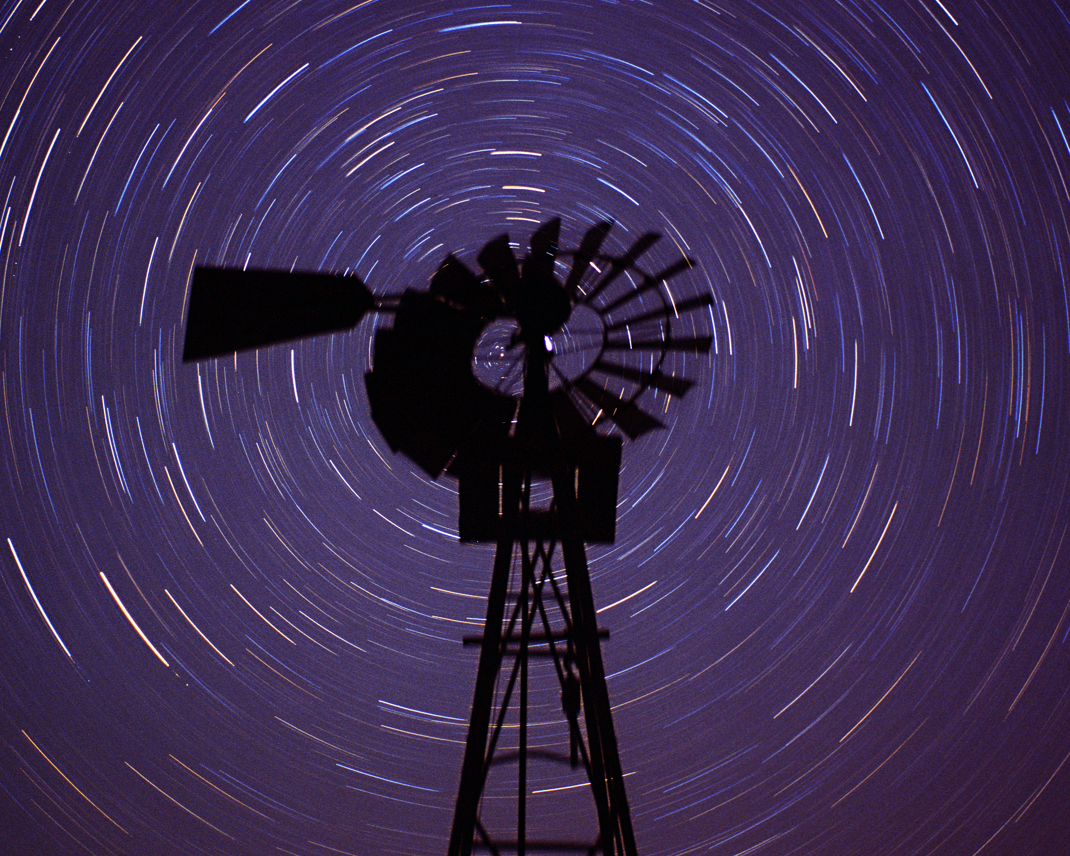
There was not a whisper of breeze, but whatever wind had previously been blowing had left the windmill blades facing south, a fortuitous placement for my composition.  I had long wanted to make a direct superposition of the windmill on the North Star, to have the startrails perfectly circumscribe the fan of blades, and here was my chance!  I set up the cameras and was surprised where they had to be placed.  After a moment I realized that this was exactly right.  At this latitude, Polaris was at 450­­ elevation, the cameras needed to be very low and aimed high to get the composition and angles to work.  Even with my wide-angle lenses, the cameras hugged the ground to get the view I wanted.

On my knees to set the tripods, aim the cameras, set the dew heaters, focus and aperture, I finally opened the shutters.  I could relax for a while.  The exposure time was going to be 80 minutes, exactly one-eighteenth of a day.  I had determined this time by counting the number of blades on the windmill, 18.  It was a detail that only a mathematician could appreciate, but I have long had suspicions that there are underlying mathematical principles to the esthetic response.  I could indulge my intuition in this farmer’s hayfield.

I looked around at the hayfield and realized that I was now surrounded by a thick fog.  I could not see more than a few yards in any direction.  So this is what happens when the air temperature falls below the dewpoint!  I was well aware of the condensation that happens when a lens, radiating heat into space, drops its temperature: it fogs!  And so here was an example of the air itself, not just a glass or metallic object, dropping below the dewpoint.  Fog!

I experienced a moment of fear. I was out in the middle of some field, I could not see, and I was not sure where my car, or even the road was.  Worse, this would ruin the pictures I was taking.  But looking up, the sky above was clear.  I was in a circular container of fog with the top still open.  I could not see any farmhouse lights, my innate sense of direction is poor, but I had the stars to guide me!

If I was not familiar with the sky I would have remained a little frightened, cocooned by a featureless mist with no pointer back to my home base, the car.  Instead, I felt somewhat protected.  I couldn’t see the traffic on the road, but then again, they couldn’t see me.  Their headlights couldn’t penetrate to my camera setup, and no one would wonder what I was doing in the middle of this field.  The sky above was open, and my pictures were progressing just fine.

Knowing that I had been traveling north on the road, with the field on the right, I took the steps west, leaving my cameras behind in the fog, until I encountered the road, then north until I found my parked car.  I was back at my base camp.  I now had a problem.  How do I get back to the cameras when their exposure time was up? 

My GPS tracker was the answer.  I set a waypoint at my car’s location, and then headed back into the fog with the navigation device to find my cameras, this time by “dead reckoning”.  I had only a sense of their direction relative to the car and so I set off hoping to see the silhouette of the windmill in a reasonable range.  If I didn’t find it, I could always return to the car by aiming for its waypoint, and try again.  The GPS signals have no trouble penetrating fog.  Fortunately, I found the cameras on my first foray.  In a truly worst case, I would have had to wait til morning for the fog to burn off in order to find them.  The exposures would have been long ruined, but I would have recovered my equipment.

With markers at both ends of my route, I could now make my way back and forth through the night, each time wandering a slightly different route, but always ending up on target.

Eventually however, the sky covered up completely and even my guiding stars could not be seen.  I’m glad this didn’t happen earlier in the evening, before I had my GPS markers set.  I would not have been able to find the car so easily.  As silly as it sounds to be lost in a hayfield, it would have been a frightening experience.  As I packed up and ferried my gear back to the car, following the GPS breadcrumbs, I contemplated the situation I had encountered.  My windmill whiteout was a personal lesson in the loss of orientation that explorers experience when they meet more dangerous whiteout conditions.  I would advise modern explorers to bring their GPS units!

“Polar Windmill”, a remarkable confluence of opportunity, weather, and technology.  This was the last night sky photograph I took on my Nightscape Odyssey, coming full circle to the first.

Nightscape Odyssey
previous | contents | next

7 Trail to the Tetons

7.1 Idaho Oasis

Most people think of Oregon as being a heavily forested state, because of all of the logging issues and the beautiful coastline with its rainforest edging, but, like Washington, Oregon is mostly… desert. The waters and moist clouds of the western shores are sequestered by the Cascade mountain range. As a result, the eastern two-thirds of the state are arid, though punctuated with areas of high-altitude forest, and irrigated orchards.

Evidently, the forest areas are subject to fire, and with infrequent rains, the fires go unchecked for days and weeks. This summer in particular has been bad, and, consistent with the sunset I enjoyed at Crater Lake, a brilliant red ball drops to the horizon as I drive across this sparsely populated region.

The towns are far between, but offer the services to road-weary travelers, and to road-savvy truckers. I stop at Jake’s truck stop in Bend Oregon, an important refueling center. For the first time I see a “truck-wash”, a facility designed to efficiently clean the miles of dust and grime from an 18-wheeler. I hadn’t ever thought about it before, but of course there must be a way of rejuvenating the chrome and gleam of these giant beasts of burden. A truck wash is the natural explanation for why the trucks you encounter on the interstate are not all dirt-gray, but usually display their billboard-size logos with pride and polish.

I refuel at Jake’s. My car takes its usual 17 gallons, and I decide to go for the restaurant. I discover that, unlike some restaurants in the cosmopolitan coast of the state, this one had a smoking section. In fact, it was pretty much all smoking section. There was a small side room with some empty tables for nonsmokers, and, discovering that the main room was choking full, the staff struggling to keep up with the clients, I took my place in the smaller room and was handed a menu by an otherwise idle server.

Continue reading

2.3 Rainy Days, Espresso Nights

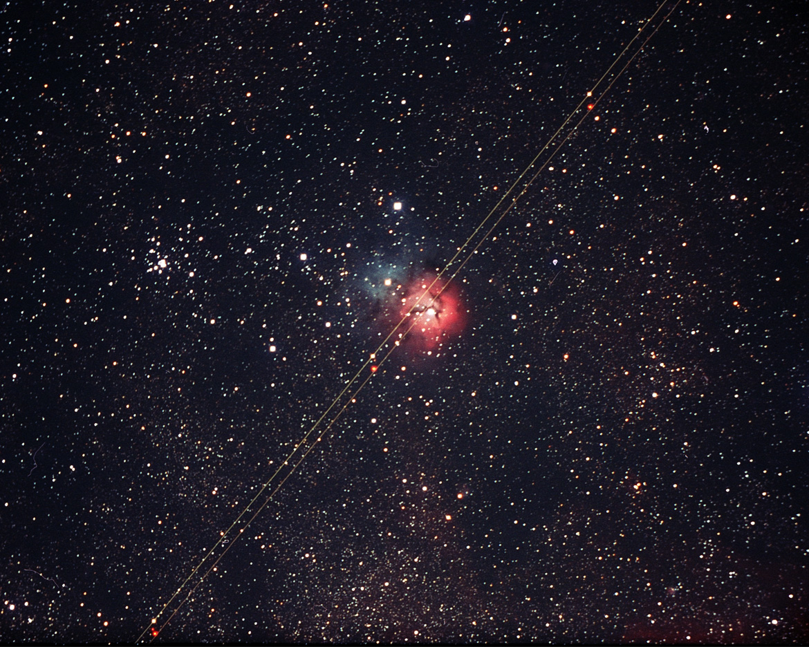
There’s always something. I managed to get the tracking and focus properly set for this shot of the Trifid Nebula, but sometime during the exposure an airplane cruised by with its running lights on.  Note the three pairs of white and red “stars” along the track from the plane’s flashing beacons.

Most attendees had given up and gone to bed with the cloud cover at midnight. A few of us accidentally enjoyed its clearing after 2:00. We took in views of galaxies, nebulas and star clusters until the near-dawn when Saturn, and then Jupiter and Venus appeared. This was the intoxicating finale of the evening, and with the brightening sky, I staggered to my tent sometime after 4:00.

Continue reading

1.3 Crossing the Prairie

Even as one exits daily life, its anxieties drag along. I headed west on highway 12, a route that could take me to Montana and beyond. The interval between rural Minnesota towns was a consistent five miles, a day’s round trip in the days of horse-driven vehicles. Although I had no need or desire to stop, I found these distances between  oases of civilization annoying–my progress seemed so slow. As I crossed into South Dakota however, and the distances started getting longer, I found my tempo slowing to match. The rhythm of the car on the pavement was beginning to seem more natural. I had no appointments or obligations, other than my desire to reach Washington for the Table Mountain Star Party.  And even that was not an obligation, I could change my plans at will!

Go west!  Ride the road and make my plans on the run. I could go as far as I wanted, stop where I felt like it, and make my way, my way. And like the title of the book by William Least Heat-Moon, I was traveling the blue highways. Except by the conventions of today’s maps, the lesser traveled roads are marked in red, not blue. The two-lane roads serviced the rural business, farms and ranches, and the segments between the small-town hives of activities became longer as the hives themselves became smaller.

Continue reading