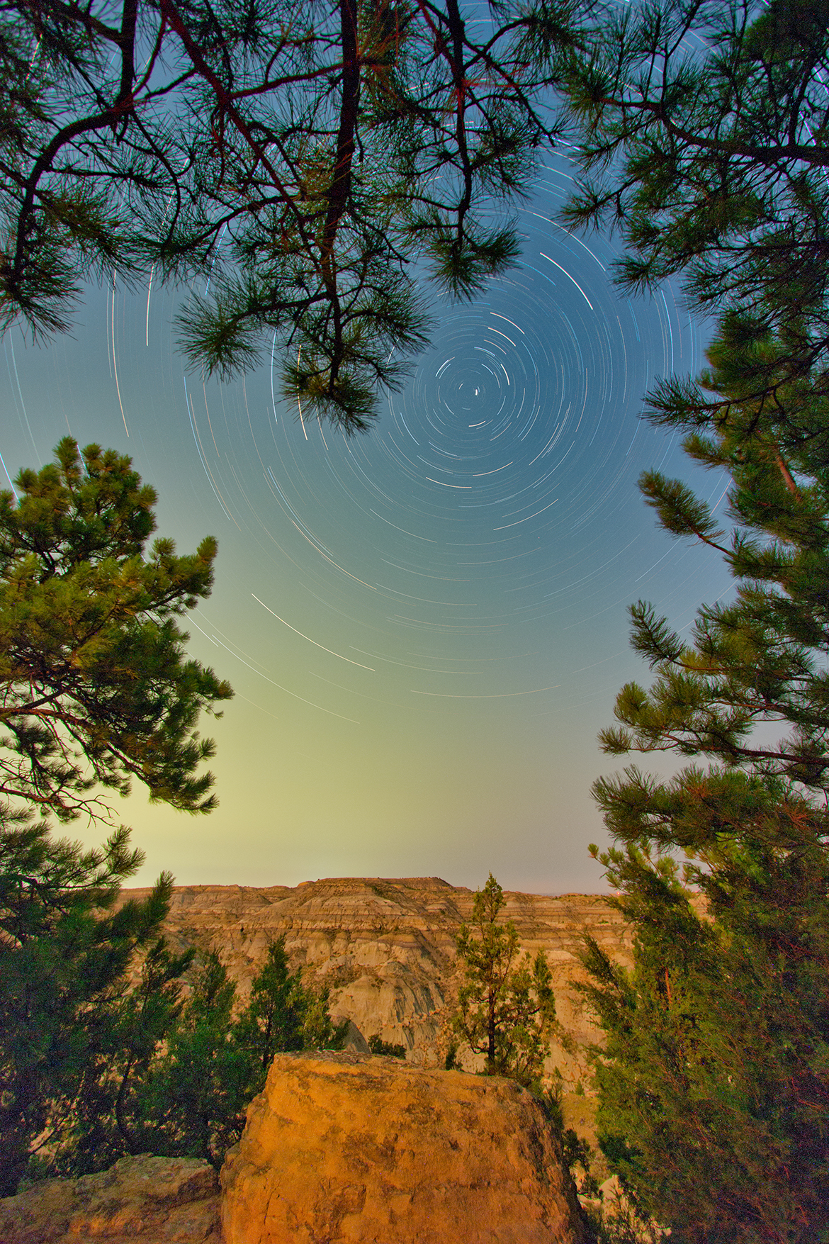
A beautiful state park along Montana’s Dinosaur Trail.
Makoshika State Park, Montana
24 August 2015
Canon EOS 60Da 10-22mm (10mm), ISO 400
Two-hour composite of 5-minute exposures at f/5.6
previous | nightscapes index | next


A beautiful state park along Montana’s Dinosaur Trail.
Makoshika State Park, Montana
24 August 2015
Canon EOS 60Da 10-22mm (10mm), ISO 400
Two-hour composite of 5-minute exposures at f/5.6
previous | nightscapes index | next
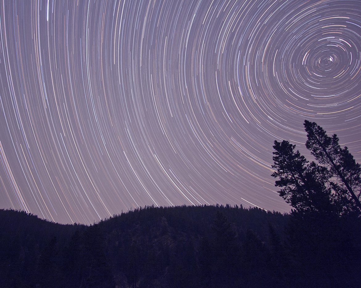
A serendipitous stay at a National Forest campground, where we enjoyed the burbling sounds of the river and watched fly-fishers ply their way into the waters to apply their fishing skills. At night, the stars travel their usual paths and the sky silhouettes the pine covered ridge on the other side of the creek.
Pioneer Mountains Scenic Byway, Montana
14 August 2015
Canon EOS 60Da 10-22mm (10mm), ISO 800
Two-hour composite of 15-minute exposures at f/8
previous | nightscapes index | next
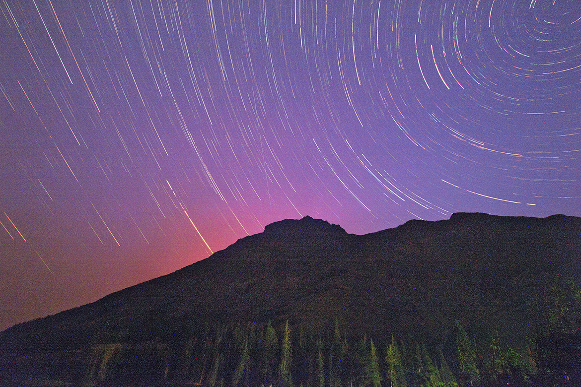
Forest fires have become common occurrences in our western states, a consequence of global warming, and our national parks are not immune. On this date we could enjoy the facilities of our campground at Two Medicine Lake, but other areas of the park were closed off, including those just north of the distinctive peak of Rising Wolf. The glow of the fire is reflected by the smoke in the sky in this startrail exposure.
Glacier Park, Montana
13 August 2015
Canon EOS 60Da 10-22mm (10mm)
Composite of 4-minute exposures, f/8, ISO 800
previous | nightscapes index | next
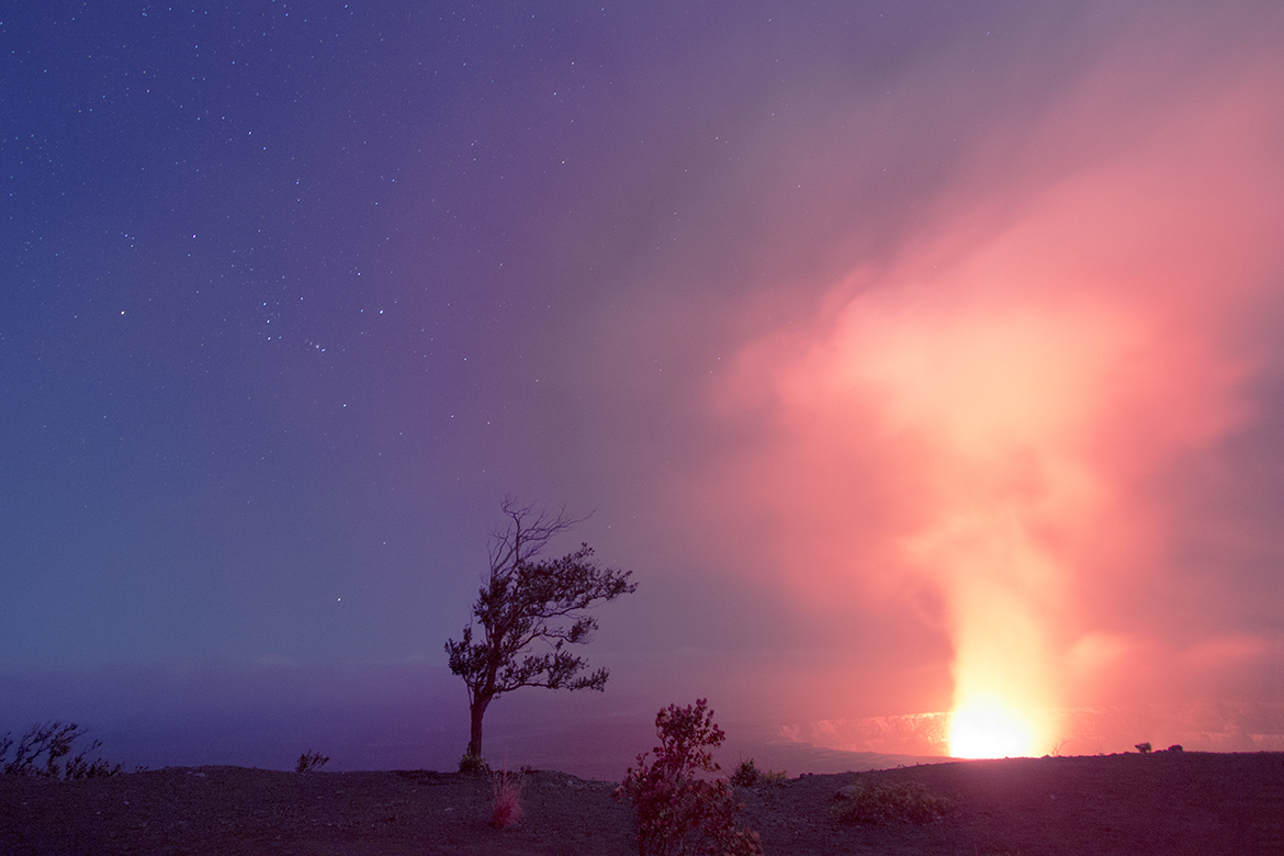
Kilauea is an active volcano on the Big Island, Hawaii, and the central feature of Volcano National Park. In the previous years there had been lava flows from vents further down the slopes of the edifice, but the crater at the top maintained a relatively stable pool of molten rock and gas emissions, stable enough that roads, trails, and a visitor center were constructed along the rim for visitors to enjoy and learn from.
The visitor center was very popular, especially at night, and on this evening we enjoyed the spectacle of a lake of hot lava, along with many others that overflowed the visitor center parking lot. Park rangers gave presentations as we watched the boiling cauldron emit a plume of gases and steam. As I prepared a camera on a tripod, one of them made a suggestion that I could step beyond the tourist line and find a position along the crater wall that would offer a more photogenic view.
I was very appreciative of this implicit permit, and soon found a position along the trail where I could include the fiery exhalation of the lake of lava, a tree that had survived these conditions for its lifetime, and a view of the sky that included the constellation of Orion.
Volcano National Park, Hawaii
28 December 2014
Canon EOS 60Da 10-22mm (10mm)
30 sec, f/4, ISO 800
previous | nightscapes index | next
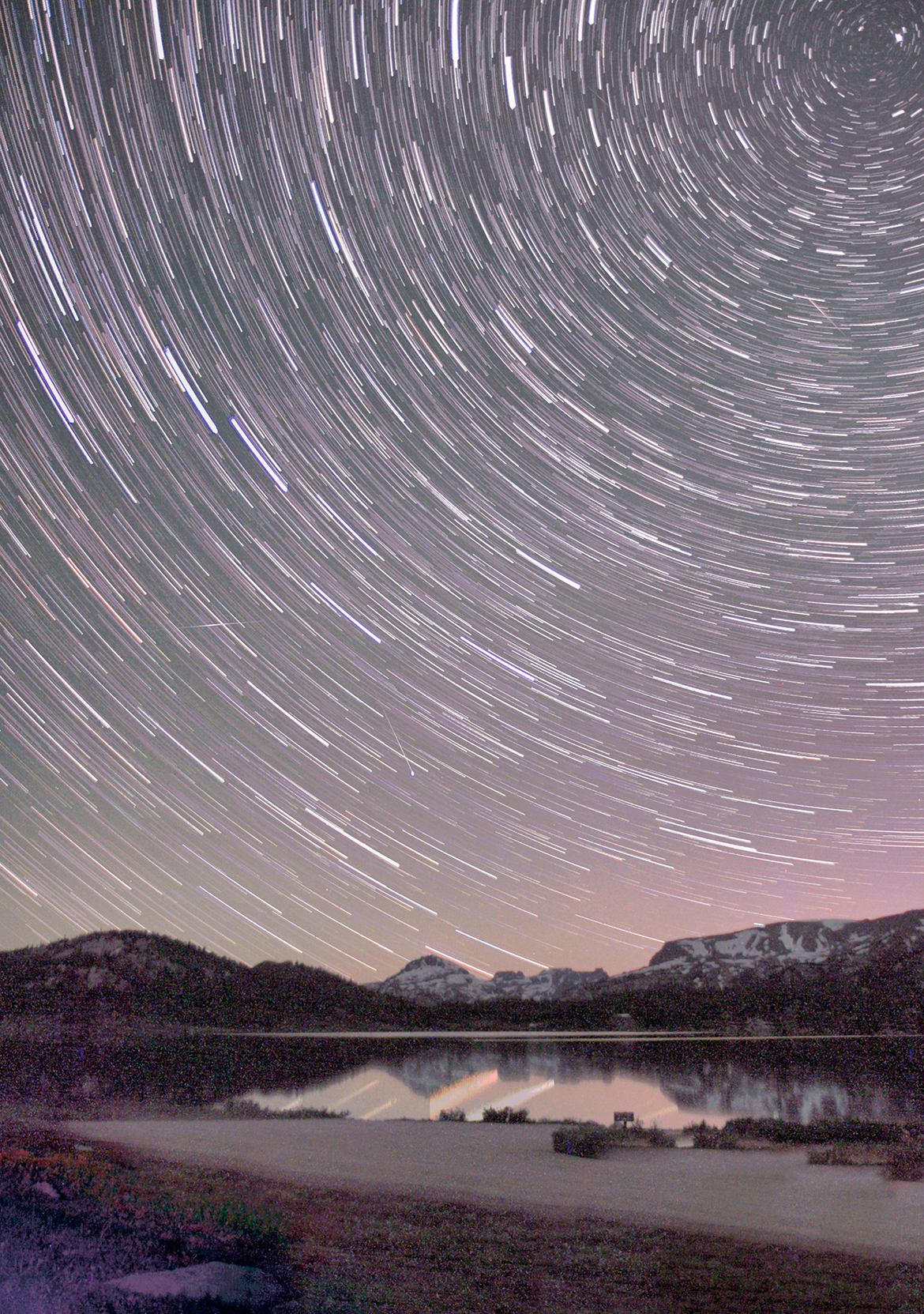
I had been here before, in 2001, attempting to recreate a scene of the night sky reflected in a calm alpine lake. I didn’t succeed then, but here I was with another opportunity. I’m still not fully satisfied; I guess I will have to come back and try again!
Beartooth Pass, Montana
25 July 2011
Canon EOS 20Da, 17-55mm (17mm), ISO 1600, f/2.8
previous | nightscapes index | next
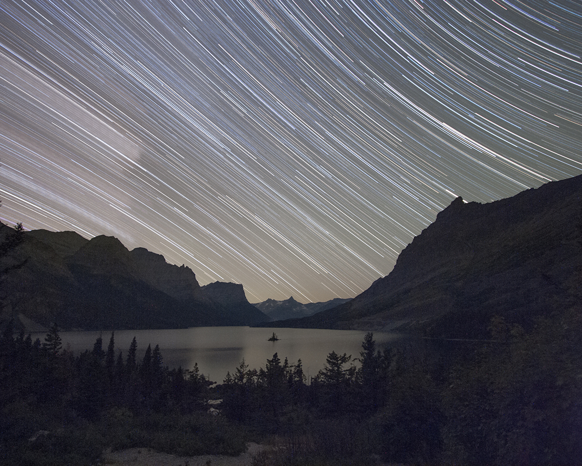
I return to this iconic overlook in Glacier Park and try again. Previously (2001), the weather compromised the view, tonight it is perfectly clear and the traffic over Logan Pass nonexistent. The pink smudge to the left is not a cloud, it is the core of the Milky Way, moving its way across the sky on a beautifully clear August night.
Glacier Park, Montana
25 August 2009
Canon EOS 20Da, 10-22mm (10mm) at f/3.5, ISO 3200
Composited series of 8-second exposures over a duration of two hours
previous | nightscapes index | next
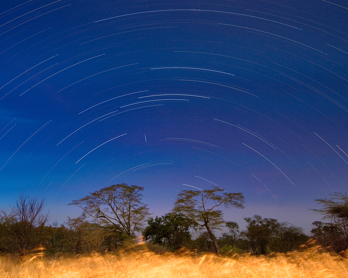
A safari in Tanzania takes one just south of the Earth’s equator. Here there is no visible North Star; it resides just below the horizon, obscured by the acacia trees and grasses of the Serengeti plain. A startrail image reveals its implicit location; the arcs to the north are perfect semicircles.
Serengeti National Park, Tanzania
14 June 2008
Canon EOS 30D, EF-S 10-22mm at 10mm
composite of 3-minute exposures at f/8, ISO 400
previous | nightscapes index | next
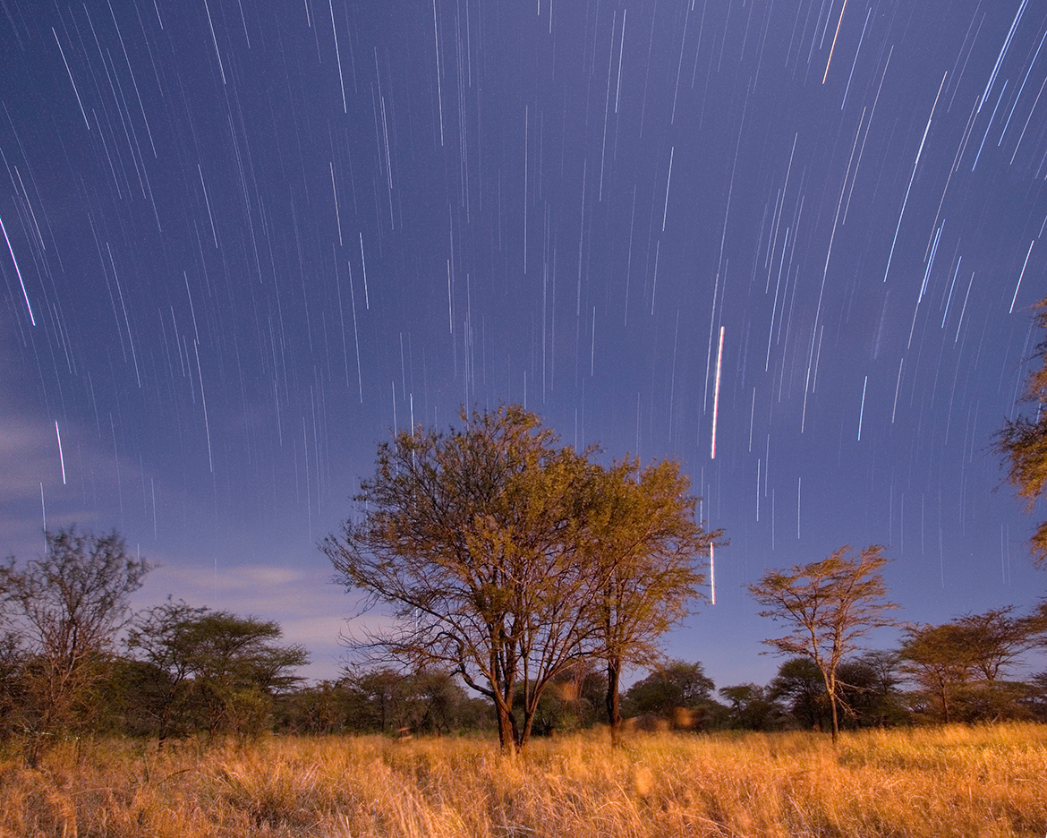
A safari in Tanzania takes one almost exactly to the Earth’s equator. A camera pointed east to make a startrail image will show those due-east stars taking paths perfectly perpendicular to the horizon. Stars to the north and south bend toward their respective centers of apparent motion.
Serengeti National Park, Tanzania
14 June 2008
Canon EOS 30D, EF-S 10-22mm at 10mm
composite of 3-minute exposures at f/6.7, ISO 400
previous | nightscapes index | next
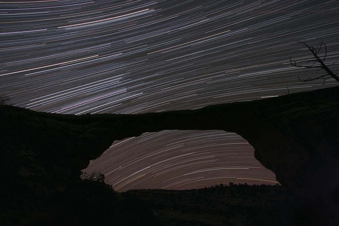
The view to the south at Owachomo Natural Bridge does not include the south celestial pole, but it clearly shows the stars revolving around it. At higher elevations, the stars transition across the celestial equator, and then arc the other way, following the rules for the northern hemisphere.
Natural Bridge Owachomo (South)
15 Nov 2007
EOS 20Da, EF-S 10-22mm at 10mm
18x5min, f/6.7, ISO 800
previous | nightscapes index | next
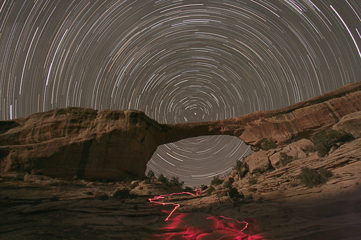
Natural Bridges National Monument is in Utah and is the first International Dark Sky Park. It is so remote, and the air so dry, that one can see stars all the way to the horizon! And nowhere on that horizon is any hint of city light dome. The park itself is powered by a solar array; the residents are misers in conserving their battery power.
The bridges are not to be confused with “arches” (found in a national park elsewhere in the state), as they are formed by different geologic processes. There are three popular bridges here, accessible by short hikes. This one suited my purposes best, lying on an east-west axis and in a valley allowing a view at the celestial pole. Across a dry riverbed, I found the position to capture this low angle composition.
I set up my cameras (I was also shooting film) and started the exposure sequence. The moon was in the process of setting and it illuminated the texture of the rocks, and also helped me find my way back to the trail head where I had a telescope and mount. I enjoyed some deep sky observing, but then needed to get back to tend my cameras. The 15-minute hike was now in complete darkness. A flashlight was needed to avoid wandering off into the desert at a missed trail marker, and the last of it was the climb under the bridge and down into the riverbed. The route I took is apparent.
Natural Bridge Owachomo (North)
15 Nov 2007
EOS 20Da, EF-S 10-22mm at 10mm
18x5min, f/6.7, ISO 800
previous | nightscapes index | next